 Processing of building borders ( red lines)
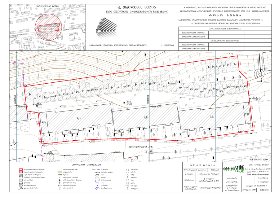
· Definition of building borders and field topo surveying in scale 1:500 by the high precision geodesic devices (GPS, Total Station), data processing by GIS and AutoCAD programmes, making red lines drawings in scale 1:500 for submitting to Tbilisi Architecture Department.
Back